- 1701 Wynkoop St: 79
- 1701 Wewatta St: 33
- 1900 Block Market St: 31
- 1701 Chestnut Pl: 30
- 20th St / Market St: 29
- 1448 Market St: 27
- 20th St / Larimer St: 27
- 1550 Wewatta St: 25
- 1800 Block Chestnut Pl: 24
- 1900 18th St: 23
- 1950 Chestnut Pl: 22
- 1738 Wynkoop St: 21
- 1949 Market St: 20
- 1400 Block Market St: 19
- 1800 Block Market St: 19
- 1946 Market St: 19
- 1800 Block Larimer St: 19
- 1800 Wazee St: 19
- 17th St / Wewatta St: 15
- 1822 Blake St: 15
- 1394 Market St: 14
- 1601 Chestnut Pl: 13
- 1801 Market St: 13
- 16th St / Wazee St: 12
- 2205 19th St: 12
- 16th St / Blake Wazee Aly: 11
- 1200 Block 19th St: 11
- 1520 20th St: 11
- 1201 16th St: 10
- 1700 Block Chestnut Pl: 10
- 19th St / Market St: 10
- 14th St / Market St: 10
- 20th St / Blake St: 10
- 1919 Blake St: 10
- 1600 Block 18th St: 10
- 1750 Wewatta St: 9
- 1700 Wewatta St: 9
- 1900 16th St: 9
- 1400 Block Little Raven St: 9
- 1801 Chestnut Pl: 9
- 18th St / Blake St: 9
- 17th St / Wynkoop St: 9
- 1200 17th St: 9
- 16th St / Lawrence St: 9
- 1750 Little Raven St: 8
- 1800 Block Little Raven St: 8
- 16th St / Chestnut Pl: 8
- 1777 Chestnut Pl: 8
- 1920 Market St: 8
- 1512 Larimer St: 8
- 1499 Wynkoop St: 8
- 17th St / Wazee St: 8
- 1250 14th St: 8
- 1700 Block Bassett St: 8
- 1300 Block 20th St: 8
- 1480 Wewatta St: 7
- 1500 Block Little Raven St: 7
- 18th St / Market St: 7
- 16th St / Market St: 7
- 1865 Larimer St: 7
- 1901 Wazee St: 7
- 1255 19th St: 7
- 15th St / Wewatta St: 6
- 1601 Wewatta St: 6
- 1700 Block Wewatta St: 6
- 1200 Block 16th St: 6
- 1300 Block 16th St: 6
- 1900 Block Little Raven St: 6
- 1920 Chestnut Pl: 6
- 1840 Market St: 6
- 1941 Market St: 6
- 16th St / Larimer St: 6
- 14th St / Larimer St: 6
- 1925 Blake St: 6
- 1801 Wynkoop St: 6
- 1420 Wynkoop St: 6
- 1612 Wazee St: 6
- 18th St / Wazee St: 6
- 20th St / Wazee St: 6
- 1626 Wazee St: 6
- 1700 Block Wazee St: 6
- 1600 Block Blake Wazee Aly: 6
- 16th St / Wazee Wynkoop Aly: 6
- 2000 Block 19th St: 6
- 1400 Block Delgany St: 6
- 1959 Wewatta St: 5
- 1400 Wewatta St: 5
- 1600 Block Wewatta St: 5
- 19th St / Little Raven St: 5
- 20th St / Little Raven St: 5
- 1900 Little Raven St: 5
- 1999 Chestnut Pl: 5
- 1700 Block Market St: 5
- 1661 Market St: 5
- 1500 Block Larimer St: 5
- 1900 Block Larimer St: 5
- 1700 Block Blake St: 5
- 16th St / Blake St: 5
- 1660 Wynkoop St: 5
- 1850 Wazee St: 5
- 2059 19th St: 5
- 1700 Bassett St: 5
- 2101 15th St: 5
- 1500 Block Wewatta St: 4
- 15th St / Little Raven St: 4
- 1500 Little Raven St: 4
- 1700 Block Little Raven St: 4
- 1880 Little Raven St: 4
- 15th St / Market St: 4
- 1550 Market St: 4
- 1401 Market St: 4
- 1616 Market St: 4
- 1600 Block Larimer St: 4
- 1414 Larimer St: 4
- 1700 Block Larimer St: 4
- 19th St / Larimer St: 4
- 1392 Larimer St: 4
- 1902 Blake St: 4
- 1801 Blake St: 4
- 1900 Block Blake St: 4
- 15th St / Blake St: 4
- 19th St / Blake St: 4
- 1601 Blake St: 4
- 1500 Wynkoop St: 4
- 1430 Wynkoop St: 4
- 1401 Wynkoop St: 4
- 1800 Block Wynkoop St: 4
- 1745 Wazee St: 4
- 1743 Wazee St: 4
- 1600 Block Wazee Wynkoop Aly: 4
- 1980 18th St: 4
- 1225 17th St: 4
- 1601 19th St: 4
- 1975 19th St: 4
- 1475 Lawrence St: 4
- 1515 Delgany St: 4
- 1801 Wewatta St: 3
- 1777 Wewatta St: 3
- 1515 Wewatta St: 3
- 1400 Block 16th St: 3
- 1600 Block Little Raven St: 3
- 1460 Little Raven St: 3
- 1850 Chestnut Pl: 3
- 20th St / Chestnut Pl: 3
- 1600 Block Market St: 3
- 1410 Market St: 3
- 1437 Market St: 3
- 1551 Larimer St: 3
- 1500 Block Blake St: 3
- 1725 Blake St: 3
- 1555 Blake St: 3
- 1660 Blake St: 3
- 1962 Blake St: 3
- 1709 Blake St: 3
- 17th St / Market Blake Aly: 3
- 1730 Wynkoop St: 3
- 1500 Block Wynkoop St: 3
- 16th St / Wynkoop St: 3
- 15th St / Wynkoop St: 3
- 18th St / Wynkoop St: 3
- 1720 Wazee St: 3
- 1608 Wazee St: 3
- 1758 Wazee St: 3
- 1601 Wazee St: 3
- 1800 Block Wazee St: 3
- 19th St / Wazee St: 3
- 15th St / Wazee St: 3
- 1615 18th St: 3
- 1634 18th St: 3
- 1332 18th St: 3
- Blake St / 18th St: 3
- 1401 17th St: 3
- 1850 Bassett St: 3
- 18th St / Lawrence St: 3
- 1600 20th St: 3
- 18th St / Wewatta St: 2
- 1900 Block Wewatta St: 2
- 1400 16th St: 2
- 2000 16th St: 2
- 1475 16th St: 2
- 1441 Little Raven St: 2
- 1610 Little Raven St: 2
- 18th St / Chestnut Pl: 2
- 17th St / Chestnut Pl: 2
- 1725 Chestnut Pl: 2
- 1417 Market St: 2
- 1691 Market St: 2
- 1416 Market St: 2
- 1515 Market St: 2
- 1450 Larimer St: 2
- 1400 Larimer St: 2
- 1375 Larimer St: 2
- 15th St / Larimer St: 2
- 1777 Larimer St: 2
- 14th St / Blake St: 2
- 1530 Blake St: 2
- 1855 Blake St: 2
- 17th St / Blake St: 2
- 1755 Blake St: 2
- 1920 Blake St: 2
- 1930 Blake St: 2
- 1730 Blake St: 2
- 1775 Blake St: 2
- 1560 Blake St: 2
- 1800 Block Market Blake Aly: 2
- 1700 Block Wynkoop St: 2
- 1605 Wynkoop St: 2
- 1700 Wynkoop St: 2
- 1595 Wynkoop St: 2
- 19th St / Wynkoop St: 2
- 1404 Wynkoop St: 2
- 1899 Wynkoop St: 2
- 1421 Wazee St: 2
- 1740 Wazee St: 2
- 1444 Wazee St: 2
- 1401 Wazee St: 2
- 1408 Wazee St: 2
- 15th St / Blake Wazee Aly: 2
- 17th St / Blake Wazee Aly: 2
- 1700 Block Blake Wazee Aly: 2
- 1600 Wazee Wynkoop Aly: 2
- 1400 Block 18th St: 2
- 1331 18th St: 2
- 1900 Block 18th St: 2
- Blake St / 14th St: 2
- 1920 17th St: 2
- 1600 17th St: 2
- 1705 17th St: 2
- 1400 Block 17th St: 2
- 2030 17th St: 2
- 1433 17th St: 2
- 1900 Block 19th St: 2
- 1801 Bassett St: 2
- 19th St / Bassett St: 2
- 1600 Block Bassett St: 2
- 20th St / Lawrence St: 2
- 1672 Lawrence St: 2
- 1415 15th St: 2
- 1490 Delgany St: 2
- 1320 20th St: 2
- 29th St / 20th St: 2
- Market St / 20th St: 2
- 2000 Block 20th St: 2
Featured: Read the October 2025 Denver-city crime report.
Denver crime maps
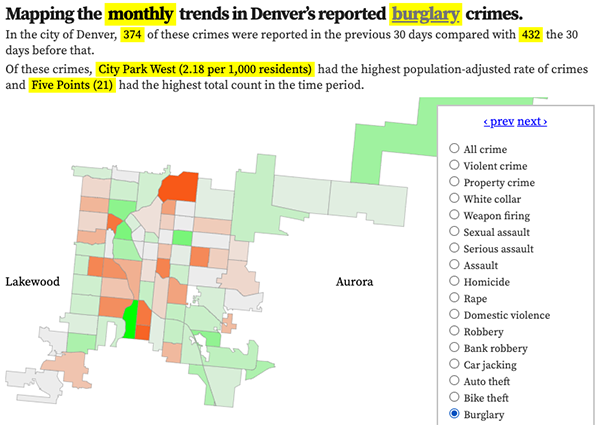
Denver crime trends map
The crimes trends map shows the change in crime counts and rates on a monthly and year-to-date basis.

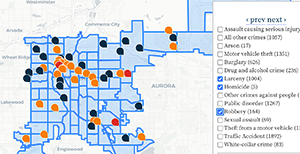
The Denver-city recent crime map
The recent crimes map shows where crimes across the city were reported in the last two or so months, and shows which addresses across the city have logged the most reported crimes.

All city crime maps
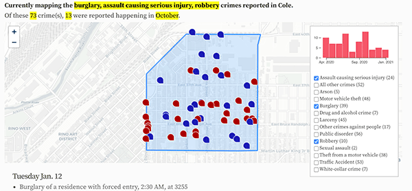
Choose from neighborhood and crime-specific crime maps.
