- 7800 E Smith Rd: 123
- 4040 N Quebec St: 46
- 8560 E Northfield Blvd: 46
- 3870 N Quebec St: 37
- No address given: 36
- 8230 E Northfield Blvd: 34
- 7757 E 36th Ave: 34
- 8340 E Northfield Blvd: 29
- 7930 E Northfield Blvd: 28
- 8200 E Smith Rd: 24
- 8101 E Northfield Blvd: 22
- 10500 E Smith Rd: 22
- 8370 E Northfield Blvd: 21
- 3730 N Quebec St: 17
- 7575 E 29th Pl: 12
- 7505 E 35th Ave: 12
- 7506 E 36th Ave: 11
- 3895 N Peoria St: 11
- 7970 E Northfield Blvd: 10
- 8298 E Northfield Blvd: 10
- 2810 N Quebec St: 9
- 4595 N Northfield Quebec St: 9
- 8568 E Northfield Blvd: 9
- 3500 N Uinta St: 9
- 3975 N Peoria Way: 9
- 7800 Block E Smith Rd: 8
- 4550 N Central Park Blvd: 8
- 12020 E 39th Ave: 8
- 8300 E Northfield Blvd: 7
- 12850 E 40th Ave: 7
- 9111 E 40th Ave: 7
- 10406 E Mlk Blvd: 7
- E 40th Ave / N Peoria Way: 6
- 7305 E 35th Ave: 6
- 7805 E 35th Ave: 6
- 10425 E 31st Ave: 6
- 4685 N Northfield Quebec St: 5
- 8470 E Northfield Blvd: 5
- 7607 E 36th Ave: 5
- 8100 E Smith Rd: 5
- 5500 N Central Park Blvd: 5
- 8499 E Stoll Pl: 5
- 3992 N Havana St: 5
- 3700 N Quebec St: 4
- 8300 Block E Northfield Blvd: 4
- 8316 E Northfield Blvd: 4
- 7306 E 36th Ave: 4
- 7797 E 36th Ave: 4
- 12090 E 40th Ave: 4
- 4667 N Central Park Blvd: 4
- 5062 N Central Park Blvd: 4
- 2033 N Central Park Blvd: 4
- 2400 N Central Park Blvd: 4
- E 35th Ave / N Wabash St: 4
- 5059 N Beeler St: 4
- 8370 E 49th Pl: 4
- 8906 E 48th Ave: 4
- 7401 E 26th Ave: 4
- 10298 E 45th Ave: 4
- 4590 N Northfield Quebec St: 3
- 3800 N Quebec St: 3
- 2850 N Quebec St: 3
- 8475 E 36th Ave: 3
- 7507 E 36th Ave: 3
- E 39th Ave / N Peoria Way: 3
- 9651 E Mlk Blvd: 3
- 7465 E Mlk Blvd: 3
- 5082 N Central Park Blvd: 3
- I70 Hwyeb / N Peoria St: 3
- 7500 Block E 29th Pl: 3
- 5173 N Beeler St: 3
- 3850 N Nome St: 3
- 8568 E 49th Pl: 3
- 8560 E 49th Pl: 3
- 4922 N Willow St: 3
- 4800 Block N Xanthia St: 3
- 7780 E 23rd Ave: 3
- 4590 N Geneva St: 3
- E 41st Ave / E Airlawn Rd: 3
- 7500 Block E 41st Ave: 3
- 7415 E 41st Ave: 3
- 8755 E Montview Blvd: 3
- 4500 Block N Northfield Quebec St: 2
- 4000 Block N Quebec St: 2
- 3710 N Quebec St: 2
- 3790 N Quebec St: 2
- 8902 E Northfield Blvd: 2
- 8314 E Northfield Blvd: 2
- 9020 E Northfield Blvd: 2
- 8200 Block E Northfield Blvd: 2
- 8271 E Northfield Blvd: 2
- N Quebec St / E Northfield Blvd: 2
- 8270 E Northfield Blvd: 2
- 7505 E 36th Ave: 2
- 7700 Block E 36th Ave: 2
- 7557 E 36th Ave: 2
- 7300 E Smith Rd: 2
- N Quebec St / E Smith Rd: 2
- 8075 E 40th Ave: 2
- 10075 E 40th Ave: 2
- 9550 E 40th Ave: 2
- 2841 N Syracuse St: 2
- 2600 Block N Syracuse St: 2
- 2800 Block N Syracuse St: 2
- 3757 N Uinta St: 2
- 4900 N Trenton St: 2
- 4740 N Florence St: 2
- 9100 Block E Mlk Blvd: 2
- 12033 E 38th Ave: 2
- N Beeler St / E 51st Ave: 2
- 3990 N Central Park Blvd: 2
- I270 Hwyeb / N Central Park Blvd: 2
- I70 Hwywb / N Peoria St: 2
- 3850 N Peoria St: 2
- 3860 N Peoria St: 2
- 7471 E 29th Pl: 2
- 5066 N Valentia St: 2
- 12000 Block E 39th Ave: 2
- 12445 E 39th Ave: 2
- 2205 N Beeler St: 2
- 7471 E 29th Ave: 2
- 2967 N Xenia St: 2
- 5000 Block N Xenia St: 2
- 9150 E 50th Ave: 2
- 4740 N Willow St: 2
- 2999 N Willow St: 2
- 9136 E 35th Ave: 2
- 7400 Block E 28th Ave: 2
- 7444 E 28th Ave: 2
- 7700 Block E 23rd Ave: 2
- 7433 E 26th Ave: 2
- 5303 N Havana St: 2
- E 37th Ave / N Havana St: 2
- 2900 Block N Havana St: 2
- 2906 N Havana St: 2
- E 40th Ave / N Havana St: 2
- 8610 E 21st Ave: 2
- 9163 E 24th Pl: 2
- N Northfield Quebec St / I70 Hwyeb: 2
- N Peoria St / I70 Hwyeb: 2
- 10155 E 29th Dr: 2
- 7311 E 29th Dr: 2
- 9095 E 47th Ave: 2
- 10325 E 49th Ave: 2
- 10498 E 49th Ave: 2
- E 37th Ave / N Quentin St: 2
- 8801 E Montview Blvd: 2
- E 39th Ave / N Uvalda St: 2
Featured: Read the March 2024 Denver-city crime report.
Denver crime maps
Denver crime trends map
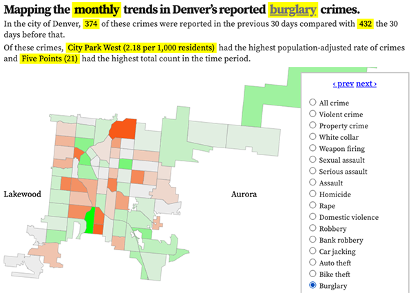
The crimes trends map shows the change in crime counts and rates on a monthly and yearly basis.

The Denver-city recent crime map
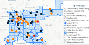
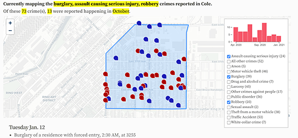
The recent crimes map shows where crimes across the city were reported in the last two or so months, and shows which addresses across the city have logged the most reported crimes.

All city crime maps
Choose from neighborhood and crime-specific crime maps.
