- 4800 N Colorado Blvd: 40
- 3700 Block N Quebec St: 36
- 4000 Block N Albion St: 30
- 3737 N Quebec St: 27
- 4330 E 48th Ave: 22
- 7201 E 36th Ave: 20
- 4055 N Albion St: 18
- 3921 N Holly St: 17
- 7260 E 36th Ave: 17
- 3800 Block N Holly St: 16
- 4100 Block N Albion St: 16
- 4600 E 48th Ave: 16
- 6240 E Smith Rd: 14
- 3801 N Quebec St: 11
- 4100 N Albion St: 10
- 3490 N Colorado Blvd: 10
- 7200 E 36th Ave: 10
- 3333 N Quebec St: 10
- 4005 N Grape St: 9
- 5725 E 39th Ave: 9
- 4355 N Kearney St: 8
- 3350 N Colorado Blvd: 8
- 4340 N Glencoe St: 8
- 3203 N Quebec St: 8
- 6200 Block E Smith Rd: 7
- 6000 Block E Smith Rd: 7
- 4300 Block E 48th Ave: 7
- E 40th Ave / N Colorado Blvd: 6
- 3500 Block N Grape St: 6
- E 40th Ave / N Quebec St: 6
- 4595 N Quebec St: 6
- 4600 Block E 48th Ave: 6
- 3880 N Newport St: 6
- 3500 Block N Pontiac St: 6
- E 36th Ave / N Pontiac St: 6
- 3300 Block N Kearney St: 5
- 4201 N Oneida St: 5
- 3600 Block N Grape St: 5
- 3601 N Quebec St: 5
- E 36th Ave / N Quebec St: 5
- 3300 Block N Dahlia St: 5
- 5025 E 39th Ave: 5
- 3500 Block N Hudson St: 5
- 3800 N Holly St: 4
- 3200 Block N Niagara St: 4
- 3990 N Kearney St: 4
- 4195 N Oneida St: 4
- 3200 N Colorado Blvd: 4
- 3600 Block N Forest St: 4
- 3600 Block N Glencoe St: 4
- 6225 E 38th Ave: 4
- 3400 Block N Elm St: 4
- 3200 Block N Elm St: 4
- E 35th Ave / N Quebec St: 4
- E Smith Rd / N Quebec St: 4
- 4685 N Quebec St: 4
- 3401 N Quebec St: 4
- 4550 E 52nd Ave: 4
- 4800 N Dahlia St: 4
- 3200 Block N Dahlia St: 4
- E 35th Ave / N Holly St: 3
- 4343 N Holly St: 3
- 3900 Block N Holly St: 3
- 4545 N Holly St: 3
- 4000 N Albion St: 3
- 3200 Block N Magnolia St: 3
- 4350 N Kearney St: 3
- E Sandown Rd / N Oneida St: 3
- 3300 N Colorado Blvd: 3
- 3400 N Colorado Blvd: 3
- 3500 Block N Forest St: 3
- 3300 Block N Forest St: 3
- 3825 N Grape St: 3
- 5201 E 38th Ave: 3
- 3421 N Elm St: 3
- 6090 E Smith Rd: 3
- 7070 E Smith Rd: 3
- 3593 N Quebec St: 3
- 3935 N Quebec St: 3
- I70 Hwyeb / N Northfield Quebec St: 3
- 3600 Block N Leyden St: 3
- 7003 E 47th Ave: 3
- 4100 Block E 35th Ave: 3
- 5100 Block E 35th Ave: 3
- 3300 Block N Pontiac St: 3
- E 38th Ave / N Pontiac St: 3
- 5000 Block E 34th Ave: 3
- 3500 Block N Dahlia St: 3
- 3200 Block N Ivanhoe St: 3
- 3600 Block N Ivanhoe St: 3
- 7007 E Sandown Rd: 3
- 3500 Block N Dexter St: 3
- I70 Hwywb / N Holly St: 2
- 3600 Block N Holly St: 2
- 4675 N Holly St: 2
- 4040 N Holly St: 2
- E 38th Ave / N Holly St: 2
- E 48th Ave / N Holly St: 2
- 4080 N Albion St: 2
- 4090 N Albion St: 2
- 4020 N Albion St: 2
- 4030 N Albion St: 2
- 4770 E 51st Ave: 2
- E Smith Rd / N Kearney St: 2
- E 39th Ave / N Oneida St: 2
- 3300 Block N Oneida St: 2
- 4000 N Colorado Blvd: 2
- 4600 Block N Colorado Blvd: 2
- 5050 N Colorado Blvd: 2
- 3345 N Forest St: 2
- 4100 N Grape St: 2
- 4433 N Glencoe St: 2
- E 47th Ave / N Glencoe St: 2
- 7155 E 38th Ave: 2
- N Poplar St / E 38th Ave: 2
- 7200 Block E 38th Ave: 2
- 3835 N Elm St: 2
- 4902 E Smith Rd: 2
- 6100 E Smith Rd: 2
- 7200 E Smith Rd: 2
- 6500 E Smith Rd: 2
- 7230 E 36th Ave: 2
- E 38th Ave / N Quebec St: 2
- 3525 N Quebec St: 2
- I70 Hwywb / N Northfield Quebec St: 2
- 3535 N Quebec St: 2
- 3555 N Quebec St: 2
- 5199 E 48th Ave: 2
- 4500 E 48th Ave: 2
- 4650 N Leyden St: 2
- 3500 Block N Newport St: 2
- 3600 N Newport St: 2
- E 39th Ave / N Newport St: 2
- 5303 E 47th Ave: 2
- 3400 Block N Ash St: 2
- 5001 E 34th Ave: 2
- 5100 Block E 34th Ave: 2
- 3500 N Dahlia St: 2
- 3500 Block N Ivanhoe St: 2
- N Holly St / E 42nd Ave: 2
- 3840 N Olive St: 2
- 3300 Block N Olive St: 2
- 5300 Block E Thrill Pl: 2
- 3200 Block N Jasmine St: 2
- 3600 Block N Dexter Ct: 2
- 3690 N Eudora St: 2
- 3500 Block N Eudora St: 2
- E 36th Ave / N Pontiac Quebec Aly: 2
- 7000 E 47th Dr: 2
Featured: Read the October 2025 Denver-city crime report.
Denver crime maps
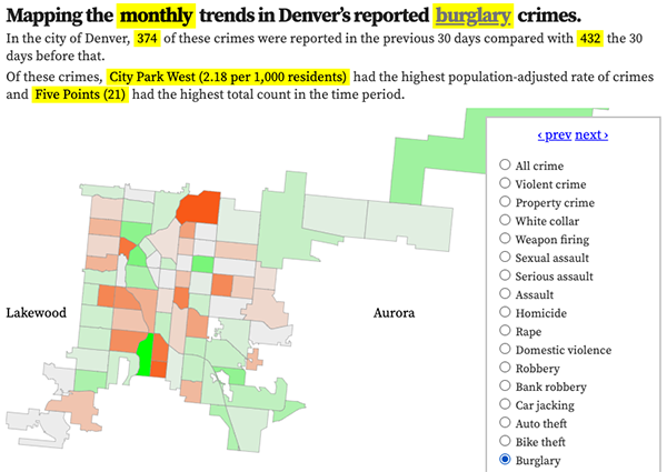
Denver crime trends map
The crimes trends map shows the change in crime counts and rates on a monthly and year-to-date basis.

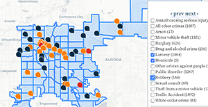
The Denver-city recent crime map
The recent crimes map shows where crimes across the city were reported in the last two or so months, and shows which addresses across the city have logged the most reported crimes.

All city crime maps
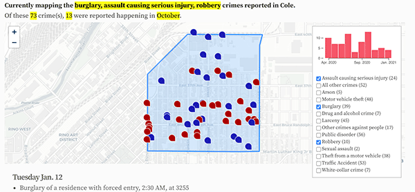
Choose from neighborhood and crime-specific crime maps.
