- 2660 N Federal Blvd: 23
- 2601 N Zuni St: 19
- 2424 N Alcott St: 12
- 2600 Block N Alcott St: 10
- 2699 N Alcott St: 10
- 1900 Block Mile High Stadium Cir: 10
- 1975 Mile High Stadium Cir: 9
- 2785 N Speer Blvd: 8
- 2700 Block N Speer Blvd: 7
- 2700 Block W 28th Ave: 7
- 1919 Mile High Stadium Cir: 7
- 2300 Block N Eliot St: 6
- 2795 N Speer Blvd: 6
- 2700 Block N Federal Blvd: 5
- 2800 Block W 24th Ave: 5
- 2400 Block N Alcott St: 5
- 2200 Block N Eliot St: 5
- 2400 Block N Federal Blvd: 4
- 2718 W 28th Ave: 4
- 2700 N Decatur St: 4
- 2400 Block N Decatur St: 4
- 2170 N Bryant St: 4
- 2900 Block W 29th Ave: 4
- 2400 Block N Clay St: 3
- 2600 Block N Clay St: 3
- 2757 N Speer Blvd: 3
- I25 Hwynb / N Speer Blvd: 3
- 2800 Block W 28th Ave: 3
- 2900 Block W 28th Ave: 3
- 2460 W 26th Ave: 3
- 2501 W 26th Ave: 3
- 2300 Block N Decatur St: 3
- 2600 Block N Bryant St: 3
- 2920 W 29th Ave: 3
- 2715 W 25th Ave: 2
- 2700 Block W 25th Ave: 2
- 2600 Block W 25th Ave: 2
- 2700 N Federal Blvd: 2
- 2846 N Federal Blvd: 2
- 2700 Block W 24th Ave: 2
- 2900 Block W 24th Ave: 2
- 2100 Block N Clay St: 2
- 2500 Block N Eliot St: 2
- 2650 N Eliot St: 2
- 2243 N Eliot St: 2
- W 23rd Ave / N Eliot St: 2
- I25 Hwysb / W 23rd Ave: 2
- 2831 W 23rd Ave: 2
- 2900 Block W 23rd Ave: 2
- 2899 N Speer Blvd: 2
- I25 Hwysb / N Speer Blvd: 2
- I25 Hwy_nb / N Speer Blvd: 2
- 2823 W 28th Ave: 2
- 2909 W 28th Ave: 2
- 2777 Mile High Stadium Cir: 2
- 2480 W 26th Ave: 2
- 2600 Block W 26th Ave: 2
- 2700 Block N Decatur St: 2
- 2824 N Decatur St: 2
- 2500 Block N Bryant St: 2
- 2100 Block N Bryant St: 2
- 2000 Block N Bryant St: 2
- 2900 Block W 21st Ave: 2
- 700 Water St: 2
- N Speer Blvd / I25 Hwy_nb: 2
- 2600 Block W Front View Cres: 2
- 2121 Childrens Museum Dr: 2
Featured: Crime reports for Denver schools.
Denver crime maps
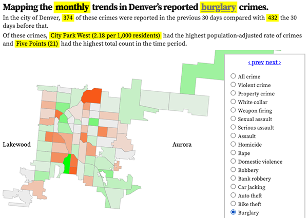
Denver crime trends map
The crimes trends map shows the change in crime counts and rates on a monthly and year-to-date basis.

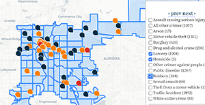
The Denver-city recent crime map
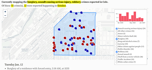
The recent crimes map shows where crimes across the city were reported in the last two or so months, and shows which addresses across the city have logged the most reported crimes.

All city crime maps
Choose from neighborhood and crime-specific crime maps.
