- 1416 Platte St: 83
- 2960 N Speer Blvd: 19
- 2298 W 28th Ave: 13
- 3500 Rockmont Dr: 10
- 2800 Block N Vallejo St: 9
- 2401 15th St: 9
- 3210 N Shoshone St: 9
- 1550 Platte St: 8
- 1701 Platte St: 8
- 2715 17th St: 8
- 1720 Platte St: 7
- 3200 Block N Shoshone St: 7
- 2500 Block 18th St: 7
- 1620 Platte St: 6
- 1300 Block W 35th Ave: 6
- I25 Hwynb / 20th St: 6
- 2400 Block W Dunkeld Pl: 6
- 2205 W 29th Ave: 6
- 3000 Block N Vallejo St: 5
- 2727 N Zuni St: 5
- 2800 Block N Zuni St: 5
- 3200 Block N Navajo St: 5
- 2400 Block W Caithness Pl: 5
- 2424 W Caithness Pl: 5
- 3758 N Osage St: 5
- 2200 Block W 28th Ave: 5
- W 38th Ave / N Lipan St: 5
- 2100 Block W 30th Ave: 5
- 2420 17th St: 5
- 2990 N Speer Blvd: 5
- 1441 Central St: 5
- 3041 N Zuni St: 4
- 2900 Block N Zuni St: 4
- 3234 N Navajo St: 4
- 2500 W 38th Ave: 4
- 3696 N Osage St: 4
- 3425 N Lipan St: 4
- 3700 Block N Tejon St: 4
- 3200 Block N Eliot St: 4
- 3500 Block Rockmont Dr: 4
- 2373 15th St: 4
- 2900 Block N Umatilla St: 4
- 2800 Block W 33rd Ave: 4
- 1900 Block W 33rd Ave: 4
- 2525 18th St: 4
- 2200 Block W 29th Ave: 4
- 3000 N Vallejo St: 3
- 1615 Platte St: 3
- 1500 Block Platte St: 3
- 2926 N Zuni St: 3
- 3400 Block N Navajo St: 3
- 2501 16th St: 3
- 3200 Block N Pecos St: 3
- W 38th Ave / N Pecos St: 3
- 3400 Block N Bryant St: 3
- 2200 Block W 34th Ave: 3
- 2900 Block W 32nd Ave: 3
- 1950 W 32nd Ave: 3
- 2219 W 32nd Ave: 3
- 2376 15th St: 3
- 1700 Block Central St: 3
- 3000 Block N Umatilla St: 3
- 1836 Boulder St: 3
- 2557 W 33rd Ave: 3
- 3500 Block N Mariposa St: 3
- 2205 W 31st Ave: 3
- 2600 Block 18th St: 3
- W 29th Ave / N Vallejo St: 2
- 2811 N Vallejo St: 2
- 2900 Block N Vallejo St: 2
- 19th St / Platte St: 2
- 1553 Platte St: 2
- 1695 Platte St: 2
- 1700 Platte St: 2
- 3300 Block N Zuni St: 2
- W 29th Ave / N Zuni St: 2
- 2772 N Zuni St: 2
- W 30th Ave / N Zuni St: 2
- 3000 Block N Zuni St: 2
- W 32nd Ave / N Zuni St: 2
- 2728 N Zuni St: 2
- 3400 Block N Zuni St: 2
- 3500 Block N Navajo St: 2
- W 34th Ave / N Navajo St: 2
- 3638 N Navajo St: 2
- 3600 Block N Navajo St: 2
- 2400 Block W 38th Ave: 2
- 2630 W 38th Ave: 2
- 3400 Block N Osage St: 2
- 3600 Block N Osage St: 2
- 3300 Block N Osage St: 2
- 2100 Block W 28th Ave: 2
- 3600 Block N Lipan St: 2
- 1900 Block W 35th Ave: 2
- 2400 Block W 35th Ave: 2
- W 36th Ave / N Tejon St: 2
- W 38th Ave / N Tejon St: 2
- 2100 W 30th Ave: 2
- W 38th Ave / N Federal Blvd: 2
- 2535 17th St: 2
- 2559 16th St: 2
- 3200 N Pecos St: 2
- 3700 Block N Bryant St: 2
- W 38th Ave / N Quivas St: 2
- 3400 Block N Quivas St: 2
- 3600 Block N Eliot St: 2
- 3700 Block N Eliot St: 2
- 1400 Block W 34th Ave: 2
- 2400 Block W 32nd Ave: 2
- 2227 W 32nd Ave: 2
- 2000 W 32nd Ave: 2
- 2600 Block W 32nd Ave: 2
- 2500 15th St: 2
- 1400 Block Central St: 2
- 1819 Central St: 2
- 3538 N Alcott St: 2
- 3600 Block N Shoshone St: 2
- 3440 N Shoshone St: 2
- 2800 Block N Umatilla St: 2
- 3190 N Umatilla St: 2
- 1560 Boulder St: 2
- 1700 Block Boulder St: 2
- 1600 Block Boulder St: 2
- 15th St / Boulder St: 2
- 1500 Block Boulder St: 2
- 2800 N Wyandot St: 2
- 3031 N Wyandot St: 2
- 2747 N Wyandot St: 2
- 1934 W 33rd Ave: 2
- 3400 Block N Mariposa St: 2
- W 38th Ave / N Mariposa St: 2
- 2300 Block W 31st Ave: 2
- 2417 W 29th Ave: 2
- 2500 Block W Argyle Pl: 2
New: Which neighborhoods saw the largest change in violent crime rates in 2024.
Denver crime maps
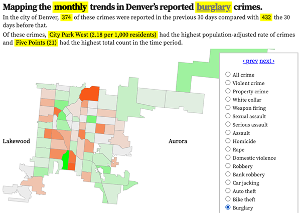
Denver crime trends map
The crimes trends map shows the change in crime counts and rates on a monthly and year-to-date basis.

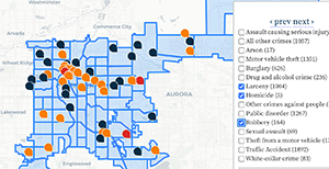
The Denver-city recent crime map
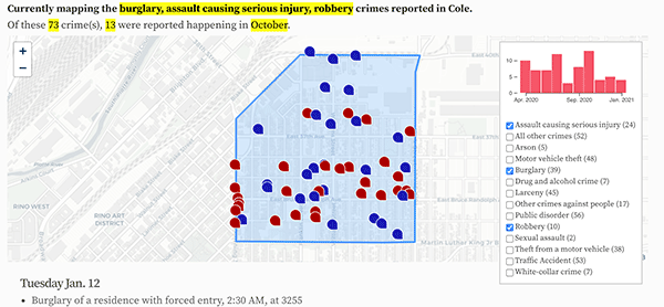
The recent crimes map shows where crimes across the city were reported in the last two or so months, and shows which addresses across the city have logged the most reported crimes.

All city crime maps
Choose from neighborhood and crime-specific crime maps.
