- 2770 W Evans Ave: 105
- 2727 W Evans Ave: 20
- 2600 Block S Federal Blvd: 13
- 2098 S Federal Blvd: 12
- 2190 S Federal Blvd: 12
- 2900 Block S Federal Blvd: 11
- 2960 S Federal Blvd: 11
- 2800 Block S Federal Blvd: 11
- 3100 Block S Federal Blvd: 10
- 2950 W Evans Ave: 10
- 2000 Block S Federal Blvd: 9
- 2396 S Federal Blvd: 8
- 3000 Block S Decatur St: 8
- 2322 S Federal Blvd: 7
- 2900 Block W Floyd Ave: 7
- 1601 W Evans Ave: 6
- W Evans Ave / S Clay St: 6
- 2929 W Floyd Ave: 6
- 2200 Block W Asbury Ave: 6
- 3100 S Federal Blvd: 5
- 2940 S Federal Blvd: 5
- 2850 S Federal Blvd: 5
- 2100 Block S Federal Blvd: 5
- 2647 W Evans Ave: 5
- 1900 Block S Navajo St: 5
- 2880 S Federal Blvd: 4
- 2418 S Federal Blvd: 4
- 3000 Block S Federal Blvd: 4
- 2070 S Federal Blvd: 4
- 2680 S Federal Blvd: 4
- 2110 S Federal Blvd: 4
- 1900 Block S Decatur St: 4
- 2400 Block W Evans Ave: 4
- 2600 Block W Evans Ave: 4
- 2980 W Evans Ave: 4
- 2100 Block S Clay St: 4
- 2100 S Clay St: 4
- 2700 Block W Iliff Ave: 4
- 2600 Block W Iliff Ave: 4
- 2050 W Asbury Ave: 4
- 2700 Block W Water Ave: 4
- 2260 S Federal Blvd: 3
- 2788 S Federal Blvd: 3
- 1401 W Evans Ave: 3
- 2900 Block W Bates Ave: 3
- 2701 W Bates Ave: 3
- 1800 Block W Asbury Ave: 3
- W Evans Ave / S Kalamath St: 3
- 1900 Block S Lipan St: 3
- 1998 S Federal Blvd: 2
- 3086 S Federal Blvd: 2
- 2912 S Federal Blvd: 2
- 2496 S Federal Blvd: 2
- 2500 Block S Federal Blvd: 2
- 1915 S Decatur St: 2
- 1991 W Evans Ave: 2
- 1600 W Evans Ave: 2
- 2800 W Evans Ave: 2
- 2626 W Evans Ave: 2
- 1310 W Evans Ave: 2
- 2700 Block W Bates Ave: 2
- 2500 Block W Bates Ave: 2
- 2808 W Wesley Ave: 2
- 2700 Block W Wesley Ave: 2
- 1900 Block S Vallejo St: 2
- W College Ave / S Clay St: 2
- 1900 Block S Bryant St: 2
- 2900 Block S Bryant St: 2
- 2100 Block W Asbury Ave: 2
- 1901 S Navajo St: 2
- 2800 Block S Zuni St: 2
- W Evans Ave / S Zuni St: 2
- 2900 Block W Amherst Ave: 2
- 2400 Block W Amherst Ave: 2
- 2910 W Amherst Ave: 2
- 1900 Block W Pacific Pl: 2
- W Evans Ave / S Lipan St: 2
- 2601 S Platte River Dr: 2
- 2220 W Jewell Ave: 2
- 2900 Block W Warren Ave: 2
- 2500 Block W Cornell Ave: 2
- 2500 Block W Water Ave: 2
- 2701 W Water Ave: 2
- W Evans Ave / S Tejon St: 2
New: Which neighborhoods saw the largest change in violent crime rates in 2024.
Denver crime maps
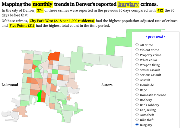
Denver crime trends map
The crimes trends map shows the change in crime counts and rates on a monthly and year-to-date basis.

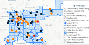
The Denver-city recent crime map
The recent crimes map shows where crimes across the city were reported in the last two or so months, and shows which addresses across the city have logged the most reported crimes.

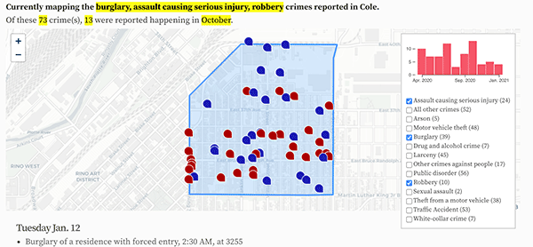
All city crime maps
Choose from neighborhood and crime-specific crime maps.
