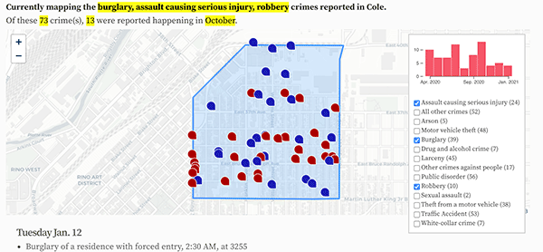
- 3550 N Downing St: 22
- 3600 Block N High St: 12
- 3240 N Humboldt St: 10
- 3360 N Downing St: 9
- 1350 40th St: 9
- 1300 Block 40th St: 9
- 3330 N Downing St: 8
- 3700 Block N York St: 8
- 3500 Block N Marion St: 6
- 3700 Block N Marion St: 6
- 3701 N York St: 6
- 2239 E Bruce Randolph Ave: 5
- 3700 Block N Humboldt St: 5
- 1580 E 39th Ave: 5
- 1500 Block E 39th Ave: 5
- 1717 E 39th Ave: 5
- 3700 Block N Race St: 5
- 3720 N Downing St: 4
- 1630 E Bruce Randolph Ave: 4
- 3900 Block N Humboldt St: 4
- 3990 N Franklin St: 4
- 3800 Block N Franklin St: 4
- 1700 Block E 33rd Ave: 4
- 1930 E 40th Ave: 4
- 3300 Block N Lafayette St: 3
- 3600 Block N Lafayette St: 3
- 3500 Block N Lafayette St: 3
- 3700 Block N High St: 3
- 3500 Block N High St: 3
- 1700 Block E Bruce Randolph Ave: 3
- 3770 Walnut St: 3
- N High York Aly / E 39th Ave: 3
- 3400 Block N Williams St: 3
- 3700 Block N Franklin St: 3
- 3500 Block N Race St: 3
- 3300 Block N Vine St: 3
- 3777 N Lafayette St: 2
- 3944 N High St: 2
- 3350 N Downing St: 2
- 1300 Block E Bruce Randolph Ave: 2
- 1209 E Bruce Randolph Ave: 2
- 3700 Block N Gilpin St: 2
- 3600 Block N Gilpin St: 2
- 3800 Block N Gilpin St: 2
- 1504 E 37th Ave: 2
- 1300 Block E 37th Ave: 2
- 3814 Walnut St: 2
- N Downing St / Walnut St: 2
- E 38th Ave / N Williams St: 2
- 3401 N Williams St: 2
- 3532 N Franklin St: 2
- E Bruce Randolph Ave / N York St: 2
- 1236 E 33rd Ave: 2
- 1704 E 33rd Ave: 2
- N Franklin St / E 40th Ave: 2
- 1806 E 40th Ave: 2
- 3400 Block N Vine St: 2
- 3200 Block N Vine St: 2
- 1918 E 35th Ave: 2
- 1700 Block E 35th Ave: 2
- E 33rd Ave / N Downing Marion Aly: 2
- 1517 E 36th Ave: 2
- 1821 E 38th Ave: 2
Updated: Colorado state crime rate charts.
Denver crime maps
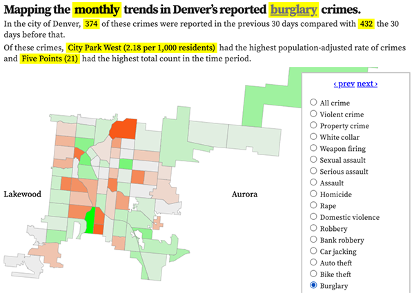
Denver crime trends map
The crimes trends map shows the change in crime counts and rates on a monthly and year-to-date basis.

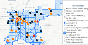
The Denver-city recent crime map
The recent crimes map shows where crimes across the city were reported in the last two or so months, and shows which addresses across the city have logged the most reported crimes.

All city crime maps
Choose from neighborhood and crime-specific crime maps.
