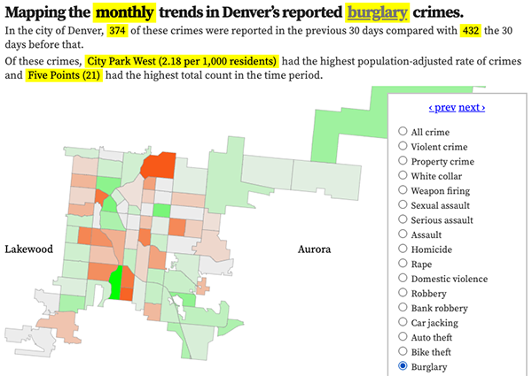
Denver neighborhood map, larcenies per 1,000 residents, 2025
Reported larcenies per 1,000 residents. Hover over or tap a neighborhood for details.
Denver larceny statistics
Monthly reported larcenies in Denver
In the last 48 months, the average number of crimes in a month was 871.1 and the median was 862.5. The most in any month was 1125, in December 2024, and the least was 353 in November 2025.
Larceny crimes, by time of day
What time reported larcenies happen in Denver.
Larceny crimes, by weekday
The day of the week reported larcenies happen.
Featured: Read the October 2025 Denver-city crime report.
Denver larcenies in the news
- Police recover hundreds of pounds of marijuana stolen from evidence trailer
- Published April 12
- Denver grocery stores are locking up or cordoning off more products. But it depends on the neighborhood.
- Published September 6, 2024
- Denver teen arrested in $20K theft of LEGOs, minifigures from Jefferson County shop
- Published May 28, 2024
- Second suspect arrested in theft from Denver’s Martin Luther King Jr. memorial
- Published March 20, 2024
Featured: The best and worst neighborhoods for larcenies.
Larceny rate, Denver, 2025
- DIA: 367.99 per 1,000 residents (453 incidents total)
- Auraria: 95.76 per 1,000 residents (79 incidents total)
- CBD: 85.45 (346)
- University Hills: 71.98 (426)
- Central Park: 69.56 (1226)
- Civic Center: 67.27 (119)
- Union Station: 64.2 (325)
- Cory-Merrill: 47.05 (222)
- Cherry Creek: 45.64 (286)
- Five Points: 35.21 (520)
- North Capitol Hill: 32.92 (195)
- Globeville: 31.82 (113)
- Lincoln Park: 31.63 (191)
- Sun Valley: 30.6 (44)
- Overland: 30.24 (98)
- Baker: 29.66 (172)
- City Park West: 27.27 (125)
- Jefferson Park: 26.88 (76)
- Montclair: 26.24 (155)
- City Park: 25.04 (80)
- Highland: 22.8 (205)
- West Colfax: 22.7 (207)
- Capitol Hill: 18.66 (293)
- College View / South Platte: 16.7 (119)
- Speer: 16.5 (194)
- Cheesman Park: 16.03 (137)
- Lowry Field: 15.87 (130)
- Northeast Park Hill: 14.86 (135)
- University: 12.88 (121)
- Clayton: 12.24 (52)
- Berkeley: 12.14 (104)
- Hale: 12.12 (82)
- University Park: 11.77 (89)
- West Highland: 10.73 (99)
- Cole: 10.65 (49)
- Elyria-Swansea: 10.49 (70)
- Congress Park: 10.32 (116)
- East Colfax: 10.22 (115)
- Virginia Village: 9.63 (136)
- Sunnyside: 8.95 (88)
- Hampden South: 8.49 (126)
- Sloan Lake: 8.45 (66)
- Washington Virginia Vale: 8.39 (116)
- Washington Park West: 8.12 (59)
- Platt Park: 8.01 (46)
- Skyland: 7.94 (25)
- Rosedale: 7.84 (19)
- Southmoor Park: 7.84 (38)
- Belcaro: 7.83 (37)
- Goldsmith: 7.79 (41)
- Mar Lee: 7.46 (102)
- Chaffee Park: 7.42 (30)
- Hampden: 7.37 (139)
- Valverde: 6.93 (26)
- Country Club: 6.59 (21)
- Windsor: 6.43 (88)
- Whittier: 6.01 (36)
- Barnum: 5.92 (39)
- Kennedy: 5.86 (27)
- South Park Hill: 5.57 (51)
- Athmar Park: 5.31 (46)
- Washington Park: 5.2 (38)
- Marston: 5.14 (58)
- Gateway / Green Valley Ranch: 5.09 (178)
- Villa Park: 5.04 (46)
- Ruby Hill: 4.9 (53)
- Westwood: 4.65 (77)
- Harvey Park South: 4.63 (41)
- Indian Creek: 4.27 (15)
- Hilltop: 4.23 (39)
- Barnum West: 3.92 (23)
- North Park Hill: 3.89 (41)
- Montbello: 3.83 (132)
- Regis: 3.56 (15)
- Harvey Park: 3.54 (45)
- Bear Valley: 3.14 (29)
- Fort Logan: 2.05 (18)
- Wellshire: 1.49 (5)
Larceny count, Denver, 2025
- Central Park: 1226 incidents
- Five Points: 520
- DIA: 453
- University Hills: 426
- CBD: 346
- Union Station: 325
- Capitol Hill: 293
- Cherry Creek: 286
- Cory-Merrill: 222
- West Colfax: 207
- Highland: 205
- North Capitol Hill: 195
- Speer: 194
- Lincoln Park: 191
- Gateway / Green Valley Ranch: 178
- Baker: 172
- Montclair: 155
- Hampden: 139
- Cheesman Park: 137
- Virginia Village: 136
- Northeast Park Hill: 135
- Montbello: 132
- Lowry Field: 130
- Hampden South: 126
- City Park West: 125
- University: 121
- College View / South Platte: 119
- Civic Center: 119
- Washington Virginia Vale: 116
- Congress Park: 116
- East Colfax: 115
- Globeville: 113
- Berkeley: 104
- Mar Lee: 102
- West Highland: 99
- Overland: 98
- University Park: 89
- Windsor: 88
- Sunnyside: 88
- Hale: 82
- City Park: 80
- Auraria: 79
- Westwood: 77
- Jefferson Park: 76
- Elyria-Swansea: 70
- Sloan Lake: 66
- Washington Park West: 59
- Marston: 58
- Ruby Hill: 53
- Clayton: 52
- South Park Hill: 51
- Cole: 49
- Villa Park: 46
- Athmar Park: 46
- Platt Park: 46
- Harvey Park: 45
- Sun Valley: 44
- Goldsmith: 41
- Harvey Park South: 41
- North Park Hill: 41
- Barnum: 39
- Hilltop: 39
- Washington Park: 38
- Southmoor Park: 38
- Belcaro: 37
- Whittier: 36
- Chaffee Park: 30
- Bear Valley: 29
- Kennedy: 27
- Valverde: 26
- Skyland: 25
- Barnum West: 23
- Country Club: 21
- Rosedale: 19
- Fort Logan: 18
- Regis: 15
- Indian Creek: 15
- : 7
- Wellshire: 5
Recent Denver larcenies
November 13
- Shoplifting, at 11:26 PM, at 1505 S Colorado Blvd in Cory-Merrill.
- Shoplifting, at 10:25 PM, at 8560 E Northfield Blvd in Central Park.
- Shoplifting, at 9:57 PM, at 3000 E 1St Ave in Cherry Creek.
- Shoplifting, at 8:03 PM, at 1600 California St in CBD.
- Shoplifting, at 6:46 PM, at 560 N Corona St in Speer.
- Theft from a building, at 4:42 PM, at 1600 California St in CBD.
- Theft from a building, at 3:00 PM, at 1530 W 13th Ave in Lincoln Park.
- Theft - other, at 2:49 PM, at the 7800 block of E 26th Ave in Central Park.
- Bicycle theft, at 2:45 PM, at the 1200 block of N Race St in Cheesman Park.
- Theft from a building, at 1:40 PM, at the 900 block of S Josephine St in Belcaro.
- Theft from a mailbox, at 12:40 PM, at 2140 S Ash St in University Hills.
- Theft - other, at 10:00 AM, at 2175 California St in Five Points.
- Bicycle theft, at 5:00 AM, at 425 S Cherokee St in Baker.
- Shoplifting, at 4:42 AM, at 93 N Quebec St in Lowry Field.
- Bicycle theft, at 4:00 AM, at the 1300 block of N Detroit St in Congress Park.
- Shoplifting, at 2:17 AM, at 3555 N Central Park Blvd in Central Park.
- Shoplifting, at 2:15 AM, at 1038 E 22nd Ave in Five Points.
- Theft from a mailbox, at 1:20 AM, at the 2600 block of W 44th Ave in Sunnyside.
- Shoplifting, at 12:02 AM, at 7930 E Northfield Blvd in Central Park.
November 12
- Shoplifting, at 11:30 PM, at 1975 E Colfax Ave in City Park West.
- Shoplifting, at 9:15 PM, at 1600 California St in CBD.
- Bicycle theft, at 9:10 PM, at 2401 Welton St in Five Points.
- Theft from a building, at 8:50 PM, at the 1000 block of N Pearl St in Capitol Hill.
- Shoplifting, at 8:32 PM, at 7805 E 35th Ave in Central Park.
- Shoplifting, at 8:30 PM, at 2730 S Colorado Blvd in University Hills.
- Shoplifting, at 8:03 PM, at 2727 W Evans Ave in College View / South Platte.
- Theft from a building, at 6:25 PM, at the 4300 block of N Raritan St in Sunnyside.
- Bicycle theft, at 5:25 PM, at the 800 block of N Broadway St in Capitol Hill.
- Shoplifting, at 4:50 PM, at 757 E 20th Ave in Five Points.
- Theft from a building, at 4:10 PM, at 3205 W Floyd Ave in Harvey Park South.
- Shoplifting, at 4:03 PM, at 990 S Monaco St in Washington Virginia Vale.
- Shoplifting, at 3:36 PM, at 560 N Corona St in Speer.
- Shoplifting, at 3:00 PM, at 4701 N Peoria St in Montbello.
- Theft - other, at 2:30 PM, at 1578 N Emerson St in North Capitol Hill.
- Theft - other, at 12:05 PM, at 1502 E 7th Ave in Country Club.
- Shoplifting, at 11:50 AM, at 7295 E 7th Ave in Montclair.
- Bicycle theft, at 9:30 AM, at the 1200 block of N St Paul St in Congress Park.
- Theft - other, at 8:13 AM, at 3992 N Havana St in Central Park.
- Shoplifting, at 12:18 AM, at 3000 E 1St Ave in Cherry Creek.
November 11
- Theft from a building, at 11:15 PM, at 8500 Pena Blvd in DIA.
- Theft - other, at 10:30 PM, at the 800 block of N Marion St in Cheesman Park.
- Shoplifting, at 10:17 PM, at 7311 E 29th Dr in Central Park.
- Bicycle theft, at 10:10 PM, at the 4100 block of S Olive St in Hampden South.
- Shoplifting, at 10:07 PM, at 3000 E 1St Ave in Cherry Creek.
- Theft - other, at 10:00 PM, at the 400 block of N Julian St in Barnum.
- Shoplifting, at 9:30 PM, at 7930 E Northfield Blvd in Central Park.
- Bicycle theft, at 6:52 PM, at 1801 California St in CBD.
- Shoplifting, at 4:56 PM, at 8150 E Colfax Ave in East Colfax.
- Bicycle theft, at 4:30 PM, at 277 N Broadway St in Baker.
- Shoplifting, at 4:29 PM, at 1600 California St in CBD.


